


Itanagar: The fourth edition of the Khangri Glacier scientific expedition has recorded a series of firsts in Arunachal Pradesh’s Tawang district, including a high-risk reconnaissance of the Dharkha Tso glacial lake and the detection of aquatic life 20 metres below the surface of Rani Lake.
The week-long mission, carried out from November 8 to 14, is a joint programme of the Centre for Earth Sciences and Himalayan Studies (CESHS) and the National Centre for Polar and Ocean Research (NCPOR), under the Union Ministry of Earth Sciences.
CESHS Director Tana Tage said the initiative aims to build deeper scientific insight into glacier behaviour, climate-linked changes and long-term water security in the Eastern Himalayas.
Launched in 2023, the annual expedition focuses on sustained glacier monitoring to strengthen cryospheric and hydrological datasets.
Led by senior glaciologist Dr Parmanand Sharma and coordinated by Nyelam Sunil, this year’s team included 11 scientists and engineers from CESHS, NCPOR Goa, Nagaland University and the North East Regional Institute of Science and Technology (NERIST).
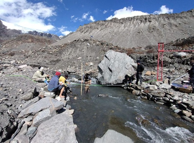
Though heavy snowfall blocked the team’s access to the glacier for summer mass balance studies, researchers deployed advanced drones to conduct high-resolution aerial surveys of the Khangri Glacier and Rani Lake.

A sonar-enabled unmanned bathymetric survey of Rani Lake provided one of the expedition’s major breakthroughs, revealing aquatic life thriving at a depth of 20 metres — a rare find in a high-altitude glacial ecosystem.
The team also retrieved crucial summer-season data from the automatic weather station and water-level recorder earlier installed on the glacier, and completed round-the-clock measurements of stream discharge downstream to assess meltwater dynamics.
A major highlight of the 2025 expedition was its first scientific scaling and reconnaissance of Dharkha Tso — one of the 29 glacial lakes identified by the NDMA as vulnerable to glacial lake outburst floods (GLOFs).
Perched at 16,145 ft in the remote Mirathang Valley, Dharkha Tso has no direct access and required a difficult 3.8-km ascent.
Scientists trekked through deep snow, tackling steep ridges, low oxygen and treacherous terrain to reach the lake, where they completed drone mapping and collected water and sediment samples for GLOF risk analysis.
CESHS said the successful mission represents a crucial advancement in India’s efforts to understand glacier health, meltwater contribution, hydrometeorological shifts and the evolving GLOF risks across the Eastern Himalayas.


