


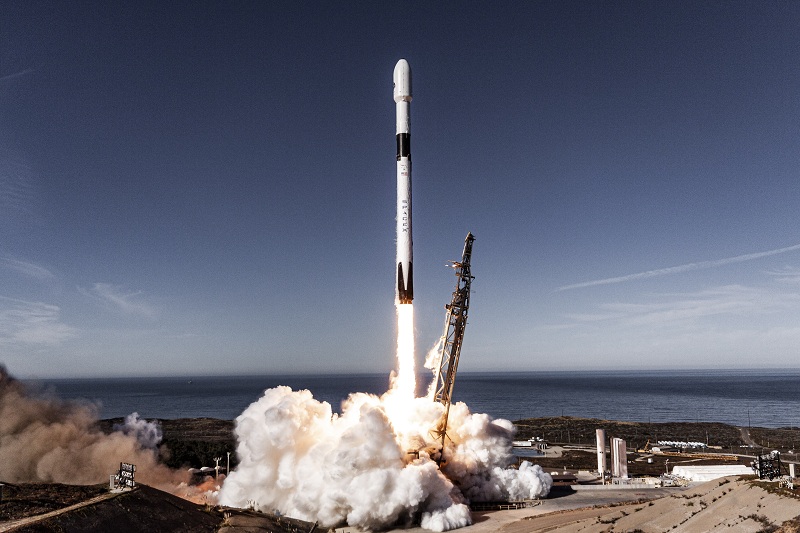
SpaceX has successfully launched the Sentinel‑6B satellite, a high‑precision sea‑level monitoring mission developed in collaboration between NASA and European partners.
Sentinel-6B is an Earth-observing satellite jointly developed by NASA, the US space agency, and European partners to observe the ocean and measure sea level rise.
The satellite lifted off aboard a Falcon 9 rocket from Vandenberg Space Force Base in California.
Sentinel‑6B is designed to continuously measure sea surface heights over about 90% of the world’s oceans, helping scientists track sea-level rise with centimetre-level accuracy.
By comparing data over the years, the mission helps assess how climate change is causing global sea levels to rise.
The information from Sentinel‑6B will be used to improve storm forecasts, better predict coastal flooding, and help protect infrastructure in vulnerable areas.

“Liftoff! The latest in a long line of satellites to monitor sea level change, Sentinel-6B, successfully launched at 12:21 am ET (10:55 AM IST) on Monday, from Vandenberg Space Force Base,” NASA said in a post on social media platform X.
“This is the second Sentinel-6 satellite Falcon 9 launched after delivering the Sentinel-6 Michael Freilich satellite to orbit in November 2020. Together, the two spacecraft will measure sea levels, improve forecasts of ocean currents as well as wind and wave conditions, and enhance both short- and long-term weather predictions,” added SpaceX.
The satellite carries a microwave radiometer to measure water vapour in the atmosphere, which affects radar signals. This allows scientists to correct sea‑height measurements more accurately.
Data from Sentinel‑6B will also contribute to refining atmospheric models—useful for NASA’s future crewed missions and for planning safe reentries.
Its main instrument is the Poseidon-4 radar altimeter, which sends radar pulses to the ocean surface and measures the time they take to return.
“Understanding tidal patterns down to the inch is critical in protecting how we use our oceans every day on Earth,” said Nicky Fox, associate administrator, Science Mission Directorate at NASA Headquarters in Washington.
ALSO READ: ISRO conducts crucial test on main parachutes for Gaganyaan Crew Module
Sea levels vary from place to place, and the satellite will provide accurate measurements at both local and global scales — all from hundreds of miles above in low Earth orbit. Those observations form the basis for U.S. flood predictions, which are crucial for safeguarding coastal infrastructure, real estate, energy storage sites, and other coastal assets.


